


This SMART 100 profile and the information it contains is a duplication of content submitted by the applicant during the entry process. As a function of entry, applicants were required to declare that all details are factually correct, do not infringe on another’s intellectual property and are not unlawful, threatening, defamatory, invasive of privacy, obscene, or otherwise objectionable. Some profiles have been edited for reasons of space and clarity.
1. THE BEGINNING
This innovation came to life when…
Two brothers were fishing off shore of Port Stephens, NSW, and weren’t sure where the location of the marine parks (restricted fishing areas) were.
Using paper maps can be very difficult on the open ocean and quite often confusing when it comes to working out your location relative to an imaginary line in the water.
They thought, “Why can’t we have this information on our phones…” and after eight months of sorting out details, we have three available for iPhone. (Although nothing for the Port Stephens area yet…)
2. WHAT & HOW
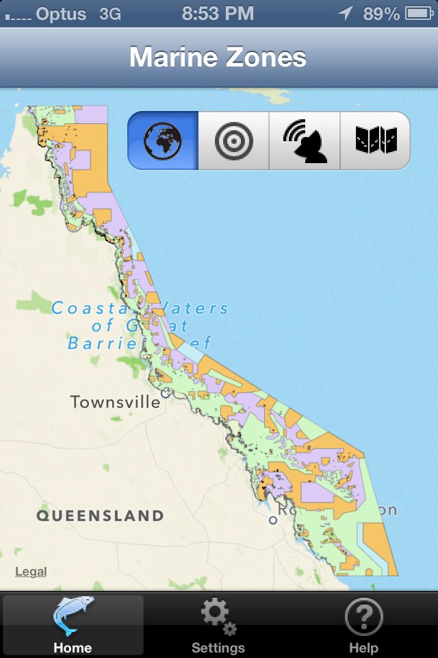
The purpose of this innovation is to…
The purpose of this innovation is to warn recreational off-shore fishers when they are in or near a marine park where fishing is not allowed, or there are certain rules that apply to that area. Helps them to not get a huge fine from authorities and to protect the environment.
It does this by…
It does this by showing the user their current location relative to the marine parks. These are essentially pre-defined shapes (areas) with different colours that represent rules for that area. The app also shows a visible and audible alert. Once the alert is triggered, user can view the relevant rule that apply to that area.
3. PURPOSE & BENEFITS
This innovation improves on what came before because…
This innovation improves on what came before because the only way a user could determine where they were was use paper maps…or spend a large sum of money on an expensive GPS machine.
Its various benefits to the customer/end-user include…
- Putting real-time information in the hands of users for a very small cost.
- Helping to avoid large fines.
- Helping protect environment and habitat for future users.
4. COMPETITIVE LANDSCAPE
In the past, this problem was solved by…
In the past, this problem was solved by people using equipment on their boats that cost hundreds and/or thousands of dollars. If they couldn’t afford that, they used paper maps and line of sight.
Its predecessors/competitors include…
Its predecessors/competitors include an app from Navionics, and app from Vic Gov’t and an app from a company named Cartmill Imaging.
5. TARGET MARKET
It is made for…
It is made for recreational fishers who use a boat to fish on open waters off-shore.
It is available for sale through…
iTunes store.
Our marketing strategy is to…
Our marketing strategy is to market any way that funds will permit. We have had the most success through television, though cash constraints have limited this method. Unfortunately we don’t have a marketing strategy…it’s been a learn-as-you-go experience.
Your Turn — VOTE!
The Readers’ Choice Index was created to provide an opportunity for Anthill readers to vote on SMART 100 applications, in one of three ways:
- Tweet it: Top left of each page (3 points)
- Trigger a Reaction: Facebook ‘Like’, etc (2 points)
- Leave a Comment: Anonymous comments excluded (1 points)
We’ll use your vote to create the 2014 SMART 100 Readers’ Choice Index.
FINE PRINT
This SMART 100 profile and the information it contains is a duplication of content submitted by the applicant during the entry process. As a function of entry, applicants were required to declare that all details are factually correct, do not infringe on another’s intellectual property and are not unlawful, threatening, defamatory, invasive of privacy, obscene, or otherwise objectionable. Some profiles have been edited for reasons of space and clarity.


